
TRIANGULATION OF INDIA: ACT TWO
TRIANGULATION OF INDIA: ACT TWO
The move to end government hegemony on generation and use of geospatial data is a potential game changer. Episode #11

Hi Everyone,
A very happy Monday to you.
Last week was very eventful.
America landed its most advanced rover on Mars. Another giant step for mankind. The journey which took 203 days to accomplish meant traversing 472 million kilometers. Sharing a clip of the landing shared by NASA.
Then petrol prices hit Rs100 per litre! Something that will test the reform mettle of the Modi government. The downside is not just serving up a political gift to the opposition; there is also the risk of stoking inflationary pressures afresh. A bit of history here: the previous NDA government led by Atal Bihari Vajpayee had blinked after a price spurt, derailing the agenda on freeing retail prices. A tough call either way: reducing duties would mean denying the bleeding exchequer precious replenishments, while sticking to a pass through of increase in international oil prices can be politically costly and risk inflation.
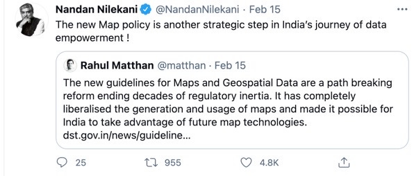
And then of course we had the big policy move by the union government to dismantle the shackles governing generation and use of geospatial data. This news break is my focus for the week. It has the potential to be an incredible game changer, defining an entirely new chapter in the mapping of India. Check out what Nandan Nilekani, the high priest of tech had to say:
Once you read this post, please, please do share a comment or drop me an email with your thoughts or ping me on twitter at @capitalcalculus. It is key to growing this newsletter and a conversation among all of us. A big shout out to Vandana B, Kapil, Yugainder, Jogesh and Premasundaran for going the extra mile to share their thoughts on my previous post. A big thank you to Aashish Chandorkar for amplifying these columns so regularly on Twitter and to Rahul Sharma for doing the same on Linkedin. And, many thanks to readers hitting the like button; more the merrier 😊.
If you are not already a subscriber, please subscribe now and spread the word.
Read on.

MAPPING OF INDIA
Last week the government of India liberalised the rules governing the acquisition and production of geospatial data. Barring a negative list, virtually every other bit of geospatial data—coordinates disclosing location information about an address, resource or installation--has been opened up for use by everyone, including the private sector.
In the process the new map policy has opened up almost infinite possibilities to explore the intersection of the digital and physical world (Ola, the taxi app, and Zomato, food delivery app, are perfect but very basic examples of this intersection). Going forward almost everything can be uniquely geo-tagged, akin to giving a 12-digit Aadhaar to every item.
And importantly enough there are no restrictions on the technology that can be deployed to capture the geospatial data. Significant because some of the tech like LIDAR (LIght Detection And Ranging or scanning using lasers), are used in autonomous vehicles for navigation.
“Any technology including but not limited to Aerial/UAV Photogrammetry, Aerial/UAV LIDAR, drones, Radar Interferometry, street view or by other means of ground survey, satellite-based remote sensing techniques, AI, underwater mapping, and others.”
To put it simply the stage is set for a fresh triangulation of India.
A task that was first undertaken over 200 years ago by the British—not with any altruistic intent, but with the explicit purpose of figuring India’s economic potential for exploitation. It is considered one of the most important surveys ever; one which employed the principles of trigonometry to map India with amazing accuracy; especially given the rudimentary tools available at that time. It also meant trekking through tough terrain, including forests inhabited by wild animals.
The method essentially involved measuring angles of a triangle based on three points picked out by the surveyor and then using a formula to calculate its exact position on earth. Not sure if many know that the height of Mount Everest, the tallest peak in the world, was measured during this survey and named after one of the key British personnel behind this exercise. Tomes have been written about this fascinating exercise so won’t labour the point. Sharing a rather irreverent take on it; but one which captures the essence of the incredible effort.
Data Rich
Obviously with the technology on hand, mapping India is not going take decades any more. Thanks to Google most of us have been led to believe that India has already been mapped. But the worst kept secret is that only about a tenth of the country has been mapped.
Anecdotally I suggest you try and map your residential address to hail a cab (or on google); inevitably you will discover that the location displayed is rarely your actual residence. Instead, it is a landmark identified by Google. In fact, the last mile to your home is recorded manually by the delivery boys and then stored in the system of Zomato etc. Geospatial data can bridge this deficit.
Just scale this capability at the level of the country (in terms of geotagging reservoirs, rivers, lakes, roads, street lights, hospitals and so on0, and you can imagine the opportunity that has opened up: both in terms of mapping India and then leveraging that data for commercial use. Exactly the reason why we have a new cliché “data is the new oil”.
For those keen for a deeper dive I would recommend viewing the discussion hosted by iSPIRIT, the most inspirational evangelical tech collective, a day after the policy makeover.
The scope and power of geospatial data was actually revealed at the time of the great cholera epidemic that struck Britain in 1854. The source and spread of the epidemic was identified after an enterprising doctor—John Snow—mapped the deaths to the sources of drinking water: in this case wells. Through this Dr Snow was able to identify the source and establish that cholera spread through consumption of contaminated water.
Goes without saying that with access to incredibly sophisticated technology available today the scope and power of geospatial data is magnified n-times over.
In the Indian context this opportunity is even that much more.
Given the alacrity with which Indian companies have taken to exploring the opportunity provided by fintech, there is every reason to believe that domestic start-ups will not pass up on this chance. In the process it will make India, as Nandan Nilekani so eloquently puts it, “data rich”; something he believes will make Indians (and of course India) economically rich.
Recommended Reading/Viewing
In case some of you wanted to follow up on my concluding quote by Nandan Nilekani, check out this talk he gave at AIMA on how India can monetise its data for both individual and collective gain.
Paper bag: 1 month
Apple core: 8 weeks
Orange peel and banana skins: 2 years
Cigarette end: 18 months to 500 years
Plastic bag: 10 to 20 years
A plastic bottle: 450 years
After reading most of us will at the least pause before they litter, if not totally stop.
Till we meet again next week. Stay safe.
This definitely comes in the category of a future shock and thanks Anil for the prior notification. Informative and a must read.
Anil what a way to connect Mars landing with opening up of India Mapping. U really are just phenomenal. This mapping process would have far greater impact on Indians than NASA mission. Imagine what all would be achieved by this move. Mind-boggling.
And Anil thanks again for selecting a topic which has the potential of being game changer for us all. Thanks. Looking forward to next Monday's article. Lighter vein, it's been a while since I looked forward to Mondays, And u have changed that. Thanks Bro.